UDiscoverIt Downloads — Biodiversity and Conservation
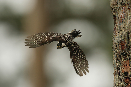
Credit: Martjan Lammertink, USDA
Accelerated biodiversity loss is another great challenge threatening our planet and humanity, especially considering the growing evidence of the importance of biodiversity for sustaining ecosystem services. The current rate of species extinction is estimated to be 100 to 1,000 times the background rates that were typical over Earth's history. Agriculture, urbanization, and deforestation are main causes of biodiversity reduction, leading to habitat loss and fragmentation. Climate change and introduction by humans of species to non-native ecosystems are further accelerating biodiversity loss.
Effective solutions to conserve biodiversity require accurate community and species-level information at relevant, actionable scales and across entire species' distributions. However, data and methodological constraints have limited our ability to provide such information in robust ways. We employ state-of-the-art deep learning and artificial intelligences technologies to exploit large observational (e.g., citizen science) and environmental (e.g., remote sensing) datasets together and estimate landscape-scale species diversity and community composition across large spatial extents. Applications highlight the utility of resulting information by identifying critical areas of high species diversity, including groups of conservation concern, for example, while capturing spatiotemporal variation in species' environmental associations and interspecific interactions.
Files
- Git repository: Deep Reasoning Network Implementation of a Deep Multivariate Probit Model (DMVP-DRNets) Code
- Zenodo archive: Deep Reasoning Network Implementation of a Deep Multivariate Probit Model (DMVP-DRNets) Code
Related Publications
- Courtney L. Davis, Yiwei Bai, Di Chen, Orin Robinson, Viviana Ruiz-Gutierrez, Carla P. Gomes, Daniel Fink. Deep learning with citizen science data enables estimation of species diversity and composition at continental extents. Ecology (2023). [pdf]
- Steve Kelling, Jeff Gerbracht, Daniel Fink, Carl Lagoze, Weng-Keen Wong, Jun Yu, Theodoros Damoulas, Carla P. Gomes. eBird: A Human/Computer Learning Network for Biodiversity Conservation and Research. IAAI 2012: 2229-2236 [pdf]
- Brian L. Sullivan, Jocelyn L. Aycrigg, Jessie H. Barry, Rick E. Bonney, Nicholas Bruns, Caren B. Cooper, Theo Damoulas, André A. Dhondt, Tom Dietterich, Andrew Farnsworth, Daniel Fink, John W. Fitzpatrick, Thomas Fredericks, Jeff Gerbracht, Carla Gomes, Wesley M. Hochachka, Marshall J. Iliff, Carl Lagoze, Frank A. La Sorte, Matthew Merrifield, Will Morris, Tina B. Phillips, Mark Reynolds, Amanda D. Rodewald, Kenneth V. Rosenberg, Nancy M. Trautmann, Andrea Wiggins, David W. Winkler, Weng-Keen Wong, Christopher L. Wood, Jun Yu, Steve Kelling. The eBird enterprise: An integrated approach to development and application of citizen science. Biological Conservation (2014). [pdf]
- Daniel Fink, Theodoros Damoulas, Nicholas E. Bruns, Frank A. La Sorte, Wesley M. Hochachka, Carla P. Gomes, Steve Kelling. Crowdsourcing Meets Ecology: Hemisphere-Wide Spatiotemporal Species Distribution Models. AI Mag. 35(2): 19-30 (2014) [pdf]
- Di Chen, Yexiang Xue, Daniel Fink, Shuo Chen, Carla P. Gomes. Deep Multi-species Embedding. IJCAI 2017: 3639-3646 [pdf]
- Di Chen, Yexiang Xue, Carla P. Gomes. End-to-End Learning for the Deep Multivariate Probit Model. ICML 2018: 931-940 [pdf]
- Shufeng Kong, Junwen Bai, Jae Hee Lee, Di Chen, Andrew Allyn, Michelle Stuart, Malin Pinsky, Katherine Mills, Carla P. Gomes. Deep Hurdle Networks for Zero-Inflated Multi-Target Regression: Application to Multiple Species Abundance Estimation. IJCAI 2020: 4375-4381 [pdf]
Reserve design is formulated as an integer linear program and solved using the CPLEX optimization software package. The optimization problem can use either realized density, potential connectivity, or density-weighted connectivity as the objective to be maximized over the reserve, subject to a hard budget constraint on purchased land parcels. The problem can also be solved with additional home range constraints specifying that only individuals whose full 95% home range (as estimated by spatial capture-recapture) is within the reserve can be considered protected.
Files
Related Publications
- Amrita Gupta, Bistra Dilkina, Dana J. Morin, Angela K. Fuller, J. Andrew Royle, Christopher Sutherland, Carla P. Gomes. Reserve design to optimize functional connectivity and animal density. Conservation Biology (2019). [pdf]
This synthetic generator can be used to study landscape connectivity conservation planning, considering both economic and ecological aspects, as well as multiple species. The generator creates randomized problem instances that represent a landscape associated with land costs and several species. For each species on the landscape, the generator creates a file describing the core habitat areas and a file describing the species-specific resistance of each cell in the landscape. The generator release includes source code and a pre-packaged benchmark of 500 instances.
Files
Related Publications
- Ronan LeBras, Bistra Dilkina, Yexiang Xue, Carla P. Gomes, Kevin S. McKelvey, Michael K. Schwartz, Claire A. Montgomery. Robust Network Design For Multispecies Conservation. AAAI 2013: 1305-1312 [pdf]
- Bistra Dilkina, Katherine J. Lai, Ronan LeBras, Yexiang Xue, Carla P. Gomes, Ashish Sabharwal, Jordan Suter, Kevin S. McKelvey, Michael K. Schwartz, Claire A. Montgomery. Large Landscape Conservation - Synthetic and Real-World Datasets. AAAI 2013: 1369-1372 [pdf]
The data consists of GIS files in Arc/Info ASCII Grid readable by most GIS systems. It describes a landscape in western Montana, USA, represented as a raster of 6×6 km cells. It includes data on two species of interest in the region: lynx and wolverines. It includes data on the the habitat core areas for the two species. It also includes data on the species-specific resistance of the land cells for each of the species. Finally, the dataset includes a cost layer, which represents the expected cost to purchase the land cell (derived from land property tax data for this region).
Files
- Lynx and wolverine data in Montana (AAAI 2013)
- Lynx and wolverine data in Montana — barriers only (AAAI 2011)
Related Publications
- Bistra Dilkina, Katherine J. Lai, Ronan LeBras, Yexiang Xue, Carla P. Gomes, Ashish Sabharwal, Jordan Suter, Kevin S. McKelvey, Michael K. Schwartz, Claire A. Montgomery. Large Landscape Conservation - Synthetic and Real-World Datasets. AAAI 2013: 1369-1372 [pdf]
- Ronan LeBras, Bistra Dilkina, Yexiang Xue, Carla P. Gomes, Kevin S. McKelvey, Michael K. Schwartz, Claire A. Montgomery. Robust Network Design For Multispecies Conservation. AAAI 2013: 1305-1312 [pdf]
- Bistra Dilkina, Katherine J. Lai, Carla P. Gomes. Upgrading Shortest Paths in Networks. CPAIOR 2011: 76-91 [pdf]
- Katherine J. Lai, Carla P. Gomes, Michael K. Schwartz, Kevin S. McKelvey, David E. Calkin, Claire A. Montgomery. The Steiner Multigraph Problem: Wildlife Corridor Design for Multiple Species. AAAI 2011: 1357-1364 [pdf]
This benchmark contains instances of the corridor design problem for grizzly bears in the Rockies. The goal is to ensure connectivity between three major national conservation parks with existing grizzly populations: the Yellowstone, Salmon-Selway and Northern Continental Divide ecosystems in Idaho, Wyoming and Montana. The study area is represented as a set of cells or parcels. The data contains the three reserves that need to be connected, plus the cost of purchase and the grizzly utility of each cell of the study area. The utility of each parcel was computed using additive aggregation over grizzly bear habitat suitability data at 30m resolution provided by the Craighead Environmental Research Institute. Land costs were computed by multiplying the amount of privately owned acreage in each parcel by the county-specific average value of farm real estate per acre, available from USDA. The data of these instances was compiled strictly for evaluation of the solution methodology and should not be used for actual conservation recommendations.
Files
Related Publications
- Bistra Dilkina, Katherine J. Lai, Ronan LeBras, Yexiang Xue, Carla P. Gomes, Ashish Sabharwal, Jordan Suter, Kevin S. McKelvey, Michael K. Schwartz, Claire A. Montgomery. Large Landscape Conservation - Synthetic and Real-World Datasets. AAAI 2013: 1369-1372 [pdf]
- Jon M. Conrad, Carla P. Gomes, Willem-Jan van Hoeve, Ashish Sabharwal, Jordan F. Suter. Wildlife corridors as a connected subgraph problem. Journal of Environmental Economics and Management (2012). [pdf]
- Bistra Dilkina, Katherine J. Lai, Carla P. Gomes. Upgrading Shortest Paths in Networks. CPAIOR 2011: 76-91 [pdf]
- Bistra Dilkina, Carla P. Gomes. Solving Connected Subgraph Problems in Wildlife Conservation. CPAIOR 2010: 102-116 [pdf]
- Carla P. Gomes, Willem Jan van Hoeve, Ashish Sabharwal. Connections in Networks: A Hybrid Approach. CPAIOR 2008: 303-307 [pdf]
- Jon Conrad, Carla P. Gomes, Willem Jan van Hoeve, Ashish Sabharwal, Jordan Suter. Connections in Networks: Hardness of Feasibility Versus Optimality. CPAIOR 2007: 16-28 [pdf]
A large class of decision and optimization problems can be captured as finding a connected subgraph of a larger graph satisfying certain cost and revenue requirements. In different realizations of the connection subgraph problem costs and profits are associated with either edges, nodes or both. Examples of this family of problems are the minimum Steiner tree, maximum-weighted connected subgraph and point-to-point connection problem. Such problems arise in a large number of applications — e.g., network design, system biology, social networks and facility location planning.
Here, we are concerned with a variant of the connected subgraph problem where we are given a graph with costs and profits associated with nodes and one or more designated nodes called terminals and we seek to find a connected subgraph that includes the terminals with maximal profit and total cost within a specified budget which we refer to as the budget-constrained Steiner connected subgraph problem with node profits and node costs.
We adapted the directed Dantzig-Fulkerson-Johnson (DFJ) formulation with subtour elimination constraints, proposed for problems with edge costs. This formulation involves an exponential number of connectivity constraints that cannot be represented explicitly for real life sized instances. To address this, we developed a Bender's decomposition approach that iteratively adds connectivity constraints to a relaxed master problem.
We show that, for critically constrained budgets, the DFJ encoding proposed here can find optimal or close to optimal solutions, dramatically speeding up runtime. For the same problem instances and budget levels, the previous state-of-the-art single flow encoding could only find considerably worse feasible solutions and much worse objective upper bounds.
Wildlife corridor design. Our work is motivated by an important instance of this problem that arises in conservation planning. Biologists have highlighted the importance of addressing the negative ecological impacts of habitat fragmentation when selecting parcels for conservation. We look at the problem of designing wildlife corridors to connect areas of biological significance (e.g., established reserves). Wildlife corridors are an important conservation method in that they increase the genetic diversity and allow for greater mobility (and hence better response to predation and stochastic events such as fire, as well as long term climate change). Specifically, in the wildlife corridor design problem, we are given a set of land parcels, a set of reserves (land parcels that correspond to biologically significant areas), and the cost (e.g., land value) and utility (e.g., habitat suitability) of each parcel. The goal is to select a subset of the parcels that forms a connected network including all reserves. This problem is clearly an instance of the connected subgraph problem with node profits and node costs, where the nodes correspond to parcels, the terminal nodes correspond to the reserves and the edges correspond to adjacency of parcels. Conservation and land use planners generally operate with a limited budget while striving to secure the land that results in the corridor with best habitat suitability. This results in the budget-constrained version of the connected subgraph problem.
Files
Related Publications
- Jon M. Conrad, Carla P. Gomes, Willem-Jan van Hoeve, Ashish Sabharwal, Jordan F. Suter. Wildlife corridors as a connected subgraph problem. Journal of Environmental Economics and Management (2012). [pdf]
- Bistra Dilkina, Carla P. Gomes. Solving Connected Subgraph Problems in Wildlife Conservation. CPAIOR 2010: 102-116 [pdf]
- Carla P. Gomes, Willem Jan van Hoeve, Ashish Sabharwal. Connections in Networks: A Hybrid Approach. CPAIOR 2008: 303-307 [pdf]
- Jon Conrad, Carla P. Gomes, Willem Jan van Hoeve, Ashish Sabharwal, Jordan Suter. Connections in Networks: Hardness of Feasibility Versus Optimality. CPAIOR 2007: 16-28 [pdf]
The red-cockaded woodpecker (RCW), Picoides borealis, is listed by the United States federal government as an endangered species. The RCW prefers mature pine forests as its habitat and takes 1–3 years to build nesting cavities in pine trees. The RCW's nesting habits support many other species in the ecosystem, making the RCW a keystone species. Due to their nesting requirements, conservation efforts focus on purchasing land parcels to be maintained as reserves, in which artificial nests for RCW are installed.
The generator of mixed integer programs in .lp format provided below was produced for research into the red-cockaded woodpecker (RCW) conservation problem. Like many species, RCW dispersion can be predicted using various simulation models influenced by geographic landscape. The MIPs provided encode the problem of choosing the set of land parcels to purchase under some budget that maximize the number of land patches inhabited by RCW across some number N of stochastic samples of an RCW dispersion model.
Files
Related Publications
- Daniel Sheldon, Bistra Dilkina, Adam N. Elmachtoub, Ryan Finseth, Ashish Sabharwal, Jon Conrad, Carla P. Gomes, David B. Shmoys, William Allen, Ole Amundsen, William Vaughan. Maximizing the Spread of Cascades Using Network Design. UAI 2010: 517-526 [pdf]
- Kiyan Ahmadizadeh, Bistra Dilkina, Carla P. Gomes, Ashish Sabharwal. An Empirical Study of Optimization for Maximizing Diffusion in Networks. CP 2010: 514-521 [pdf]
Two flight call datasets are presented in this work. All the samples were collected via extraction from recording stations, recording captive birds, or recording and labeling via direct observation. The primary dataset consists of 5 classes (species of bird) with 40 samples (flight calls) from each class for a total of 200 samples.
The data is digitized and stored as .wav files. The calls range from between 1916 and 6037 features (sampling every 4.5×10⁻⁵ seconds); each call was padded with zeros to create a uniform length dataset. As an extension to the primary data set, an auxiliary data set consisting of 42 classes (species information available from our data repository), 1180 samples, and 15075 features. Samples per class range from 10 to 40, and call lengths range from 1175 to 15075.
One of the challenges of the primary data set is that most of the samples are warblers, which tend to have structurally similar flight calls. The auxiliary data set contains a larger variety of species, and therefore greatly varying samples of flight calls.
Files
Related Publications
- Theodoros Damoulas, Samuel Henry, Andrew Farnsworth, Michael Lanzone, Carla P. Gomes. Bayesian Classification of Flight Calls with a Novel Dynamic Time Warping Kernel. ICMLA 2010: 424-429 [pdf]
2026
- Marc Grimson, Joshua Fan, Courtney L. Davis, Dylan van Bramer, Daniel Fink, Carla P. Gomes. LabelKAN - Kolmogorov-Arnold Networks for Inter-Label Learning: Avian Community Learning. AAAI 2026: 38505-38514 [pdf]
- Marc Grimson, Joshua Fan, Courtney L. Davis, Dylan van Bramer, Daniel Fink, Carla P. Gomes. LabelKAN - Kolmogorov-Arnold Networks for Inter-Label Learning: Avian Community Learning. CoRR abs/2601.18818 (2026) [pdf]
2025
- Yue Mao, Zhongdi Qu, Imanol Miqueleiz, Aaron M. Ferber, Sami Wolf, Marc Grimson, Sebastian Heilpern, Felipe Siqueira Pacheco, Alexander S. Flecker, Peter B. McIntyre, Carla P. Gomes. Expanding Connected Components from Alternative Terminals: Global Optimization for Freshwater Fishes Under the UN's 30x30 Conservation Goal. IJCAI 2025: 9808-9817 [pdf]
- Sebastian A. Heilpern, Franz W. Simon, Suresh A. Sethi, Kathryn J. Fiorella, Alexander S. Flecker, Carla Gomes, Peter B. McIntyre. Leveraging biodiversity to maximize nutrition and resilience of global fisheries. Nature Sustainability (2025). [pdf]
- Lillian R Aoki, Carmen J Ritter, Deanna S Beatty, Lia K Domke, Ginny L Eckert, Olivia J Graham, Carla P Gomes, Collin Gross, Timothy L Hawthorne, Eliza Heery, Margot Hessing-Lewis, Kevin Hovel, Karl Koehler, Zachary L Monteith, Ryan S Mueller, Angeleen M Olson, Carolyn Prentice, Brendan Rappazzo, John J Stachowicz, Fiona Tomas, Bo Yang, C Drew Harvell, J Emmett Duffy. Seagrass wasting disease prevalence and lesion area increase with invertebrate grazing across the northeastern Pacific . Ecology (2025). [pdf]
2023
- Jinzhao Li, Daniel Fink, Christopher Wood, Carla P. Gomes, Yexiang Xue. Provable Optimization of Quantal Response Leader-Follower Games with Exponentially Large Action Spaces. AAMAS 2023: 756-765 [pdf]
- Courtney L. Davis, Yiwei Bai, Di Chen, Orin Robinson, Viviana Ruiz-Gutierrez, Carla P. Gomes, Daniel Fink. Deep learning with citizen science data enables estimation of species diversity and composition at continental extents. Ecology (2023). [pdf]
- Olivia J. Graham, Tiffany Stephens, Brendan Rappazzo, Corinne Klohmann, Sukanya Dayal, Emily M. Adamczyk, Angeleen Olson, Margot Hessing-Lewis, Morgan Eisenlord, Bo Yang, Colleen Burge, Carla P. Gomes, Drew Harvell. Deeper habitats and cooler temperatures moderate a climate-driven seagrass disease. Philosophical Transactions of the Royal Society B: Biological Sciences (2023). [pdf]
2022
- Lillian R. Aoki, Brendan Rappazzo, Deanna S. Beatty, Lia K. Domke, Ginny L. Eckert, Morgan E. Eisenlord, Olivia J. Graham, Leah Harper, Timothy L. Hawthorne, Margot Hessing-Lewis, Kevin A. Hovel, Zachary L. Monteith, Ryan S. Mueller, Angeleen M. Olson, Carolyn Prentice, John J. Stachowicz, Fiona Tomas, Bo Yang, J. Emmett Duffy, Carla Gomes, C. Drew Harvell. Disease surveillance by artificial intelligence links eelgrass wasting disease to ocean warming across latitudes. Limnology and Oceanography (2022). [pdf]
2021
- Johan Bjorck, Qinru Shi, Carrie Brown-Lima, Jennifer Dean, Angela Fuller, Carla P. Gomes. Learning Augmented Methods for Matching: Improving Invasive Species Management and Urban Mobility. AAAI 2021: 14702-14710 [pdf]
- Johan Bjorck, Brendan H. Rappazzo, Qinru Shi, Carrie Brown-Lima, Jennifer Dean, Angela Fuller, Carla P. Gomes. Accelerating Ecological Sciences from Above: Spatial Contrastive Learning for Remote Sensing. AAAI 2021: 14711-14720 [pdf]
- Wenting Zhao, Shufeng Kong, Junwen Bai, Daniel Fink, Carla P. Gomes. HOT-VAE: Learning High-Order Label Correlation for Multi-Label Classification via Attention-Based Variational Autoencoders. AAAI 2021: 15016-15024 [pdf]
- Brendan H. Rappazzo, Morgan E. Eisenlord, Olivia J. Graham, Lillian R. Aoki, Phoebe D. Dawkins, Drew Harvell, Carla P. Gomes. EeLISA: Combating Global Warming Through the Rapid Analysis of Eelgrass Wasting Disease. AAAI 2021: 15156-15165 [pdf]
- Wenting Zhao, Shufeng Kong, Junwen Bai, Daniel Fink, Carla P. Gomes. HOT-VAE: Learning High-Order Label Correlation for Multi-Label Classification via Attention-Based Variational Autoencoders. CoRR abs/2103.06375 (2021) [pdf]
- Maya L. Groner, Morgan E. Eisenlord, Reyn M. Yoshioka, Evan A. Fiorenza, Phoebe D. Dawkins, Olivia J. Graham, Miranda Winningham, Alex Vompe, Natalie D. Rivlin, Bo Yang, Colleen A. Burge, Brendan Rappazzo, Carla P. Gomes, C. Drew Harvell. Warming sea surface temperatures fuel summer epidemics of eelgrass wasting disease. Marine Ecology Progress Series (MEPS) (2021). [pdf]
- Olivia J. Graham, Lillian R. Aoki, Tiffany Stephens, Joshua Stokes, Sukanya Dayal, Brendan Rappazzo, Carla P. Gomes, C. Drew Harvell. Effects of Seagrass Wasting Disease on Eelgrass Growth and Belowground Sugar in Natural Meadows. Frontiers in Marine Science (2021). [pdf]
2020
- Junwen Bai, Shufeng Kong, Carla P. Gomes. Disentangled Variational Autoencoder based Multi-Label Classification with Covariance-Aware Multivariate Probit Model. IJCAI 2020: 4313-4321 [pdf]
- Shufeng Kong, Junwen Bai, Jae Hee Lee, Di Chen, Andrew Allyn, Michelle Stuart, Malin Pinsky, Katherine Mills, Carla P. Gomes. Deep Hurdle Networks for Zero-Inflated Multi-Target Regression: Application to Multiple Species Abundance Estimation. IJCAI 2020: 4375-4381 [pdf]
- Junwen Bai, Shufeng Kong, Carla P. Gomes. Disentangled Variational Autoencoder based Multi-Label Classification with Covariance-Aware Multivariate Probit Model. CoRR abs/2007.06126 (2020) [pdf]
- Shufeng Kong, Junwen Bai, Jae Hee Lee, Di Chen, Andrew Allyn, Michelle Stuart, Malin Pinsky, Katherine Mills, Carla P. Gomes. Deep Hurdle Networks for Zero-Inflated Multi-Target Regression: Application to Multiple Species Abundance Estimation. CoRR abs/2010.16040 (2020) [pdf]
- Nathan Jensen, Elizabeth Lyons, Eddy Chebelyon, Ronan Le Bras, Carla Gomes. Conspicuous monitoring and remote work. Journal of Economic Behavior & Organization (2020). [pdf]
2019
- Johan Bjorck, Brendan H. Rappazzo, Di Chen, Richard Bernstein, Peter H. Wrege, Carla P. Gomes. Automatic Detection and Compression for Passive Acoustic Monitoring of the African Forest Elephant. AAAI 2019: 476-484 [pdf]
- Di Chen, Carla P. Gomes. Bias Reduction via End-to-End Shift Learning: Application to Citizen Science. AAAI 2019: 493-500 [pdf]
- Anmol Kabra, Yexiang Xue, Carla P. Gomes. CPU-accelerated principal-agent game for scalable citizen science. COMPASS 2019: 165-173 [pdf]
- Johan Bjorck, Brendan Rappazzo, Di Chen, Richard Bernstein, Peter H. Wrege, Carla P. Gomes. Automatic Detection and Compression for Passive Acoustic Monitoring of the African Forest Elephant. CoRR abs/1902.09069 (2019) [pdf]
- Amrita Gupta, Bistra Dilkina, Dana J. Morin, Angela K. Fuller, J. Andrew Royle, Christopher Sutherland, Carla P. Gomes. Reserve design to optimize functional connectivity and animal density. Conservation Biology (2019). [pdf]
- Yexiang Xue, Carla P. Gomes. Engaging Citizen Scientists in Data Collection for Conservation. Artificial Intelligence and Conservation (2019). [pdf]
2018
- Johan Bjorck, Yiwei Bai, Xiaojian Wu, Yexiang Xue, Mark C. Whitmore, Carla P. Gomes. Scalable Relaxations of Sparse Packing Constraints: Optimal Biocontrol in Predator-Prey Networks. AAAI 2018: 748-756 [pdf]
- Luming Tang, Yexiang Xue, Di Chen, Carla P. Gomes. Multi-Entity Dependence Learning With Rich Context via Conditional Variational Auto-Encoder. AAAI 2018: 824-832 [pdf]
- Di Chen, Yexiang Xue, Carla P. Gomes. End-to-End Learning for the Deep Multivariate Probit Model. ICML 2018: 931-940 [pdf]
- Di Chen, Yexiang Xue, Carla P. Gomes. End-to-End Learning for the Deep Multivariate Probit Model. CoRR abs/1803.08591 (2018) [pdf]
- Di Chen, Carla P. Gomes. Bias Reduction via End-to-End Shift Learning: Application to Citizen Science. CoRR abs/1811.00458 (2018) [pdf]
2017
- Yexiang Xue, XiaoJian Wu, Dana Morin, Bistra Dilkina, Angela Fuller, J. Andrew Royle, Carla P. Gomes. Dynamic Optimization of Landscape Connectivity Embedding Spatial-Capture-Recapture Information. AAAI 2017: 4552-4558 [pdf]
- Di Chen, Yexiang Xue, Daniel Fink, Shuo Chen, Carla P. Gomes. Deep Multi-species Embedding. IJCAI 2017: 3639-3646 [pdf]
- Luming Tang, Yexiang Xue, Di Chen, Carla P. Gomes. Multi-Entity Dependence Learning with Rich Context via Conditional Variational Auto-encoder. CoRR abs/1709.05612 (2017) [pdf]
- Johan Bjorck, Yiwei Bai, Xiaojian Wu, Yexiang Xue, Mark C. Whitmore, Carla P. Gomes. Scalable Relaxations of Sparse Packing Constraints: Optimal Biocontrol in Predator-Prey Network. CoRR abs/1711.06800 (2017) [pdf]
2016
- Yexiang Xue, Ian Davies, Daniel Fink, Christopher Wood, Carla P. Gomes. Avicaching: A Two Stage Game for Bias Reduction in Citizen Science. AAMAS 2016: 776-785 [pdf]
- Yexiang Xue, Ian Davies, Daniel Fink, Christopher Wood, Carla P. Gomes. Behavior Identification in Two-Stage Games for Incentivizing Citizen Science Exploration. CP 2016: 701-717 [pdf]
- Di Chen, Yexiang Xue, Shuo Chen, Daniel Fink, Carla P. Gomes. Deep Multi-Species Embedding. CoRR abs/1609.09353 (2016) [pdf]
- Bistra Dilkina, Rachel Houtman, Carla P. Gomes, Claire A. Montgomery, Kevin S. McKelvey, Katherine Kendall, Tabitha A. Graves, Richard Bernstein, Michael K. Schwartz. Trade-offs and efficiencies in optimal budget-constrained multispecies corridor networks. Conservation Biology (2016). [pdf]
2015
- Stefano Ermon, Yexiang Xue, Russell Toth, Bistra Dilkina, Richard Bernstein, Theodoros Damoulas, Patrick E. Clark, Steve DeGloria, Andrew Mude, Christopher Barrett, Carla P. Gomes. Learning Large-Scale Dynamic Discrete Choice Models of Spatio-Temporal Preferences with Application to Migratory Pastoralism in East Africa. AAAI 2015: 644-650 [pdf]
2014
- Daniel Fink, Theodoros Damoulas, Nicholas E. Bruns, Frank A. La Sorte, Wesley M. Hochachka, Carla P. Gomes, Steve Kelling. Crowdsourcing Meets Ecology: Hemisphere-Wide Spatiotemporal Species Distribution Models. AI Mag. 35(2): 19-30 (2014) [pdf]
- Theodoros Damoulas, Jin He, Richard Bernstein, Carla P. Gomes, Anish Arora. String Kernels for Complex Time-Series: Counting Targets from Sensed Movement. ICPR 2014: 4429-4434 [pdf]
- Brian L. Sullivan, Jocelyn L. Aycrigg, Jessie H. Barry, Rick E. Bonney, Nicholas Bruns, Caren B. Cooper, Theo Damoulas, André A. Dhondt, Tom Dietterich, Andrew Farnsworth, Daniel Fink, John W. Fitzpatrick, Thomas Fredericks, Jeff Gerbracht, Carla Gomes, Wesley M. Hochachka, Marshall J. Iliff, Carl Lagoze, Frank A. La Sorte, Matthew Merrifield, Will Morris, Tina B. Phillips, Mark Reynolds, Amanda D. Rodewald, Kenneth V. Rosenberg, Nancy M. Trautmann, Andrea Wiggins, David W. Winkler, Weng-Keen Wong, Christopher L. Wood, Jun Yu, Steve Kelling. The eBird enterprise: An integrated approach to development and application of citizen science. Biological Conservation (2014). [pdf]
2013
- Steve Kelling, Jeff Gerbracht, Daniel Fink, Carl Lagoze, Weng-Keen Wong, Jun Yu, Theodoros Damoulas, Carla P. Gomes. A Human/Computer Learning Network to Improve Biodiversity Conservation and Research. AI Mag. 34(1): 10-20 (2013) [pdf]
- Ronan LeBras, Bistra Dilkina, Yexiang Xue, Carla P. Gomes, Kevin S. McKelvey, Michael K. Schwartz, Claire A. Montgomery. Robust Network Design For Multispecies Conservation. AAAI 2013: 1305-1312 [pdf]
- Bistra Dilkina, Katherine J. Lai, Ronan LeBras, Yexiang Xue, Carla P. Gomes, Ashish Sabharwal, Jordan Suter, Kevin S. McKelvey, Michael K. Schwartz, Claire A. Montgomery. Large Landscape Conservation - Synthetic and Real-World Datasets. AAAI 2013: 1369-1372 [pdf]
- Yexiang Xue, Bistra Dilkina, Theodoros Damoulas, Daniel Fink, Carla P. Gomes, Steve Kelling. Improving Your Chances: Boosting Citizen Science Discovery. HCOMP 2013: 198-206 [pdf]
2012
- Steve Kelling, Jeff Gerbracht, Daniel Fink, Carl Lagoze, Weng-Keen Wong, Jun Yu, Theodoros Damoulas, Carla P. Gomes. eBird: A Human/Computer Learning Network for Biodiversity Conservation and Research. IAAI 2012: 2229-2236 [pdf]
- Jon M. Conrad, Carla P. Gomes, Willem-Jan van Hoeve, Ashish Sabharwal, Jordan F. Suter. Wildlife corridors as a connected subgraph problem. Journal of Environmental Economics and Management (2012). [pdf]
2011
- Katherine J. Lai, Carla P. Gomes, Michael K. Schwartz, Kevin S. McKelvey, David E. Calkin, Claire A. Montgomery. The Steiner Multigraph Problem: Wildlife Corridor Design for Multiple Species. AAAI 2011: 1357-1364 [pdf]
- Bistra Dilkina, Katherine J. Lai, Carla P. Gomes. Upgrading Shortest Paths in Networks. CPAIOR 2011: 76-91 [pdf]
2010
- Kiyan Ahmadizadeh, Bistra Dilkina, Carla P. Gomes, Ashish Sabharwal. An Empirical Study of Optimization for Maximizing Diffusion in Networks. CP 2010: 514-521 [pdf]
- Bistra Dilkina, Carla P. Gomes. Solving Connected Subgraph Problems in Wildlife Conservation. CPAIOR 2010: 102-116 [pdf]
- Theodoros Damoulas, Samuel Henry, Andrew Farnsworth, Michael Lanzone, Carla P. Gomes. Bayesian Classification of Flight Calls with a Novel Dynamic Time Warping Kernel. ICMLA 2010: 424-429 [pdf]
- Daniel Sheldon, Bistra Dilkina, Adam N. Elmachtoub, Ryan Finseth, Ashish Sabharwal, Jon Conrad, Carla P. Gomes, David B. Shmoys, William Allen, Ole Amundsen, William Vaughan. Maximizing the Spread of Cascades Using Network Design. UAI 2010: 517-526 [pdf]