| |
CS 5150
Software Engineering
Fall 2012
Project Suggestion: Crowd-Sourcing History
|
|
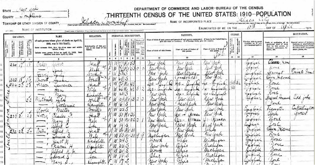
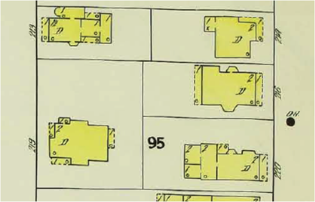
Using Sanborn Fire Insurance Maps as a portal to historic architectural and demographic information Client Robert J Kibbee Abstract With the appropriate tools this project will provide a unique opportunity for community involvement in constructing an important historical resource. The involvement can be by individual volunteers, groups of volunteers or educational institutions from schools to university classes.Project Outline Design a relational database or databases for storing records from US and New York State censuses and city directories keyed to the buildings on a historical series of Sanborn Fire Insurance Maps.Design an interface that will allow volunteers to input information from the sources, which currently exist only as images, into the project database as records with multiple, variable and searchable fields. (Record content varies from source to source). Inputters would need to “check out” the pages and return them as completed to maintain and monitor project workflow. The key index field would be the building and a database of building information would be required. Devise some method for checking accuracy of entries, perhaps by double keying or by withholding records for review before committing to the database. Design a way to display the information and link to a more complete display or displays when a building is clicked on an online version of the map. Design a search interface which can query the database and extract information for research purposes. Project Background Sanborn fire insurance maps were produced for every village and city in the United States about every seven years from 1880 to 1920. They are large-scale maps of the built environment that use a consistent scale and symbology, including color coding for building materials. See The Library of Congress site for history and examples (Hershey, Pennsylvania, 1915).Tompkins County has a fairly complete collection of local Sanborn maps. Tompkins County Public Library’s and some of the History Center’s collection has been digitized. An ongoing component of the project is to inventory locally available maps and digitize them at a consistent and appropriate standard. We propose to use the digitized maps as a portal to architectural and demographic information by linking the buildings on the maps to census, city directory and other databases of information, as well as constructing a database of the architectural attributes of the buildings themselves. A very rough prototype is available at: http://www.kibqmaps.org/TBurg%20Sanborns/Imagetest.html The image there shows the index for the Sanborn maps of Trumansburg, NY in 1905. Only the link to the image of page 3 is live. Click on that to retrieve page 3. On this page the building at 302 Congress St. is live and can be clicked. This retrieves a concept page showing the kinds of information that could be linked to the building. Some of the information for the proposed databases is available online but none is in database format. Some information exists only as paper files (for example, historic images of the buildings).The conversion of static images (for example, images of census pages or directory listings) into database records will require significant input from community volunteers, or students working on a course-based project in local history. A project database must be designed to accept information from a variety of sources. The information entered must be checked for accuracy before becoming part of a permanent record. The database must be able to be queried first by the link from the building on the map, but also independently from a search interface. The project requires a way for volunteers to input information from these sources into the project database using a web-based application and, possibly, a phone application. There needs to be a way to transfer data from census enumeration pages and the city directories. This is complicated by the fact that different questions were asked at different censuses. See the next page for an image of a partial census page from the enumeration of Ithaca in 1910. There also needs to be a way to display the information when a building is clicked. The immediate information has to be selective, but lead to additional information. There also needs to be a way to query the database directly for research purposes.
A partial page from the US of Ithaca in 1910:
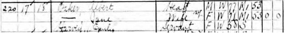
For the house at 220 South Geneva Street:
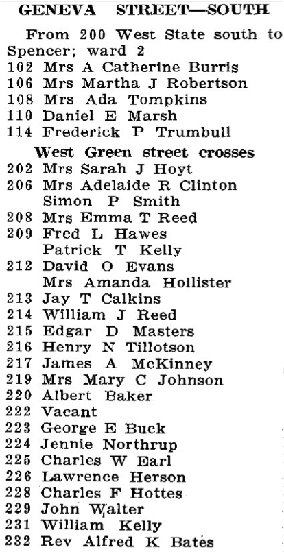
From the Ithaca City Directory of 1911:
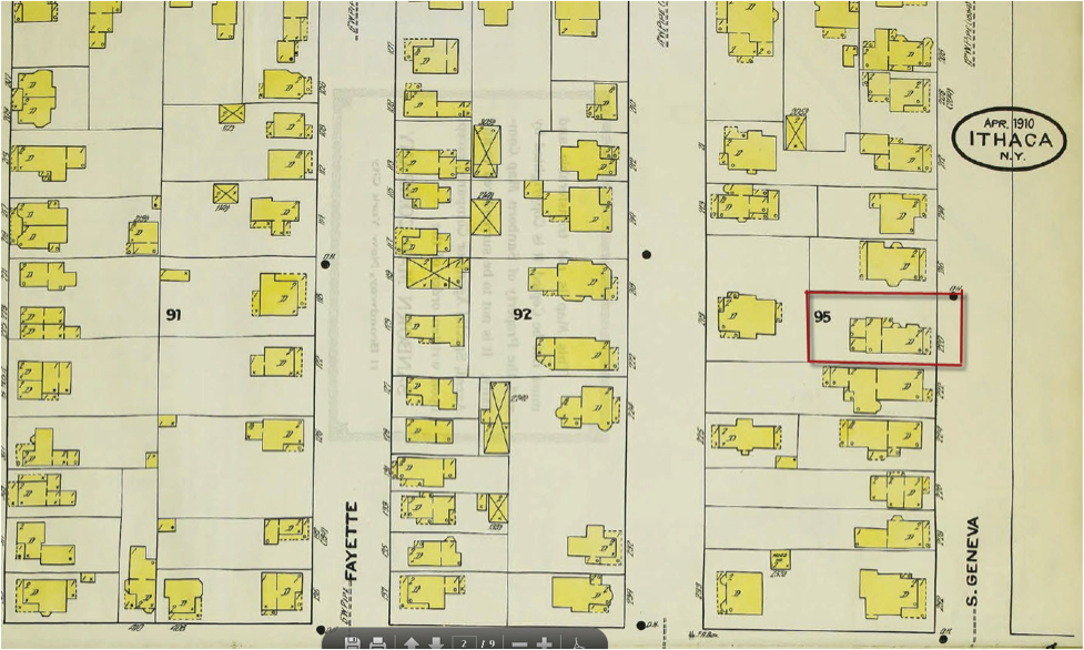
And from the Sanborn Fire Insurance Map of Ithaca for 1910:
Detail: |
[ Home ]